Use Map Controls
Pan, zoom, rotate, recenter, adjust a GeoPDF overlay, and measure temporary distances.
Move around the map
Pan and zoom Topo Map or an imported GeoPDF Map with the standard touch gestures. Maps can also rotate.
The map-orientation indicator appears when the map is rotated. Tap it to reset the map to north up while keeping the current center and zoom.
The separate device-heading compass shows the direction the iPhone is facing. It reports device heading and does not control map rotation.
Recenter on your location
Tap My Location to center the map on an accepted current location. The control is unavailable until MCG Maps has a usable location sample.
Adjust a GeoPDF overlay
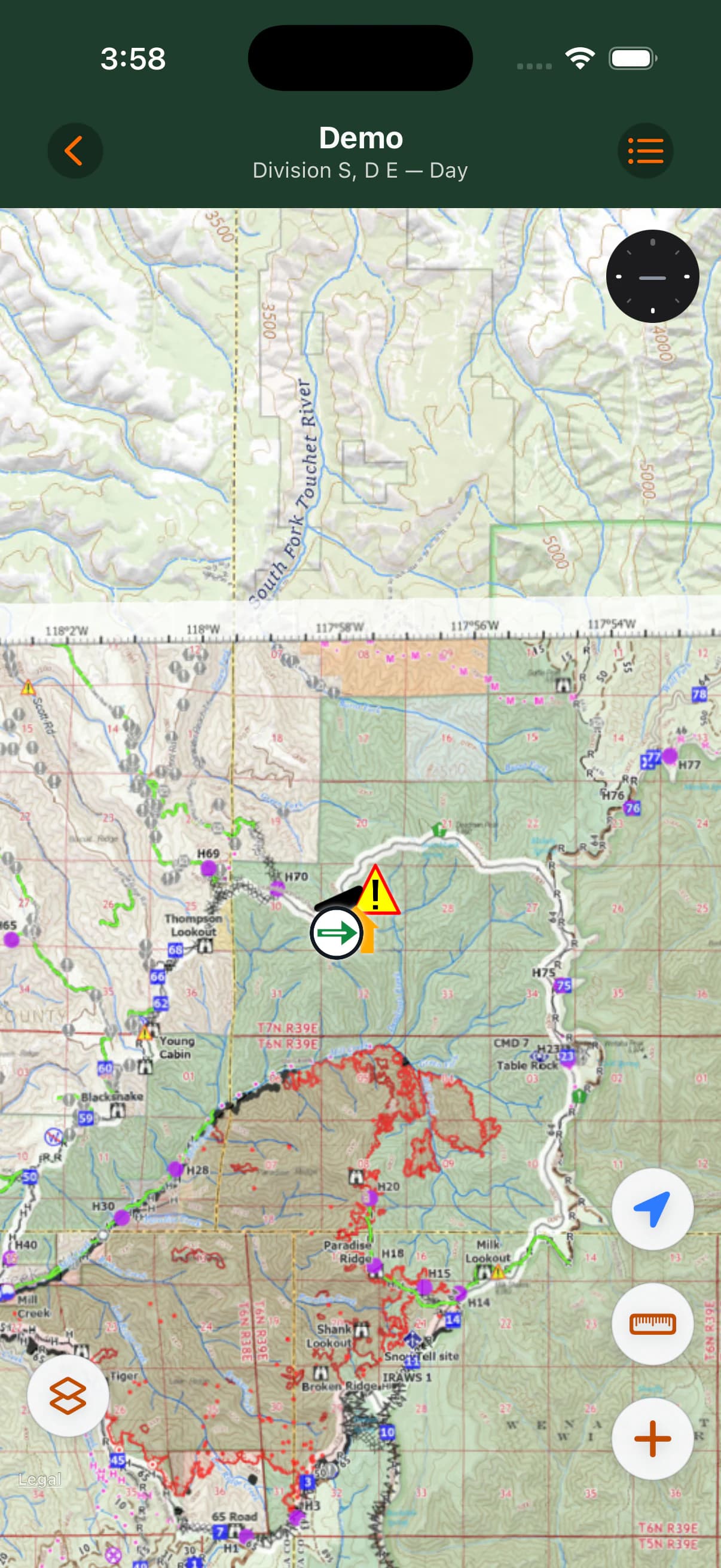
An imported GeoPDF is positioned geographically over the topo basemap. Pan beyond the PDF boundary to continue onto topo.
Change opacity or hide the basemap
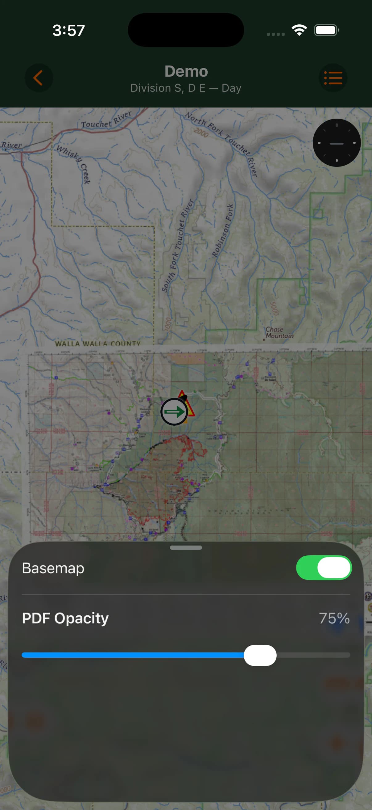
When viewing an imported GeoPDF, open PDF Opacity to adjust how strongly the PDF appears over the topo basemap.
Use the Basemap toggle in the same control to hide or show the online topo layer. The imported PDF remains locally available when the basemap or network is unavailable.
Measure distance
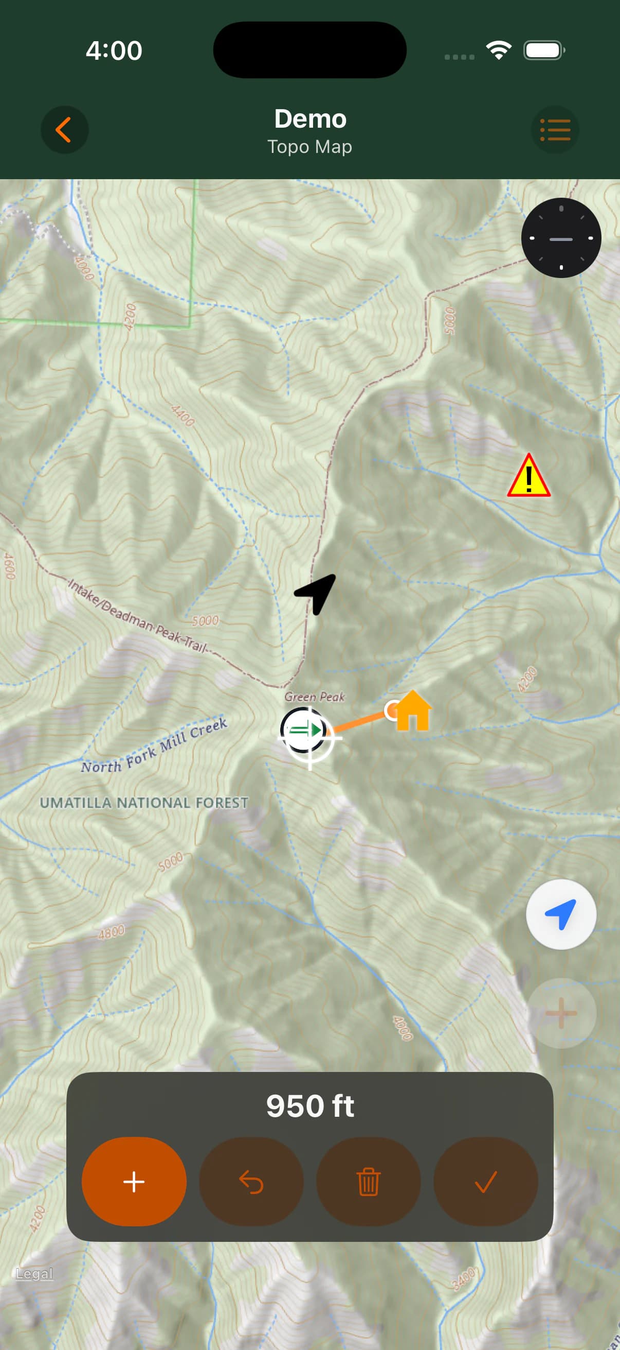
Measure Distance starts a temporary multi-segment straight-line distance measurement using geodesic segments.
Measurements are temporary and are not saved. MCG Maps does not provide area measurement or stored measurement objects.
- Pan the map until the crosshair is at the first position and tap Add Point.
- Move to the next position and tap Add Point again.
- Continue adding points to see the cumulative distance.
- Use Undo to remove the last point, or Clear to remove every point while staying in Measure mode.
- Tap Done to leave Measure mode and clear the measurement.